| Version 6 (modified by , 16 years ago) ( diff ) |
|---|
Features
-
Features
- Map layer configuration
- Main buttons hiding
- Fullscreen toggle
- New position indicator
- Batch tile download
- Notification support
- Optimized tracklog drawing, tracklog manager
- Adding of elevation data to tracklog
- Route profile drawing
- POI manager
- Finding POI using Google Local Search
- Online routing using Google Directions
- Transparent map overlay
- OSD informační ukazatele
- Uživatelský konfigurační soubor
Map layer configuration
Map layers are defined in 'map_config.conf in the modRana main fiolder.
Example:
[osma]
  label=OSM T@h
  url=http://tah.openstreetmap.org/Tiles/tile/
  type=png
  max_zoom=17
  min_zoom=0
  folder_prefix=OSM
  coordinates=osm
name in square brackets -> must be unique for every layer
label -> name of the layer shown in GUI
url -> tileserver URL, tile coordinate format is set automatically according to the value in coordinates
type -> type of the tile images
max_zoom, min_zoom -> maximal and minimal zoom
folder_prefix -> combined with tile_folder in user_config.conf sets the tile folder path
cooridnates -> sets the coordinate system and tile URL format
- all layer variables must be set
- tile storage and loading is compatible with TangoGPS
Main buttons hiding
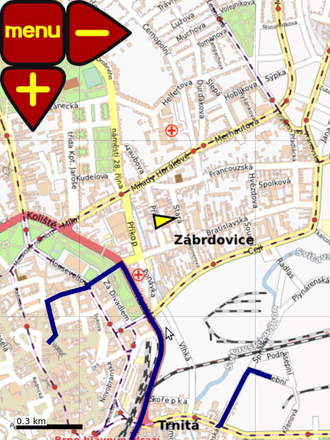
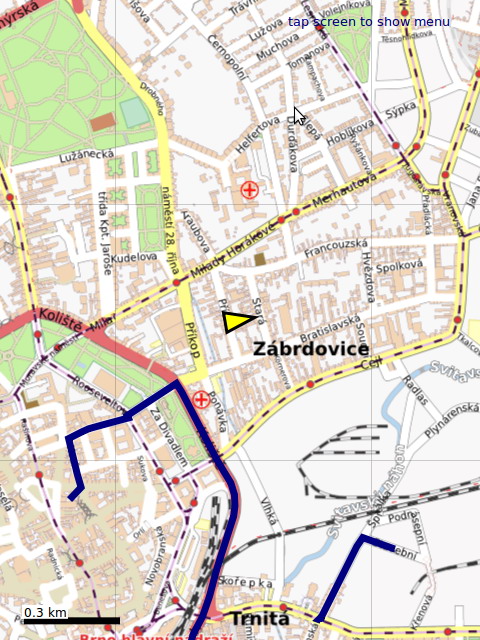
ModRana supports hiding of the main buttons, so they don't obstruct parts of the map. This feature can be configured in menu->Options->view->hide main buttons, the default is "hide after 15 seconds".
Fullscreen toggle
ModRana can be set to a fullscreen mode. Fullscreen can be toggled with the appropriate button from the map screen or main menu.
New position indicator
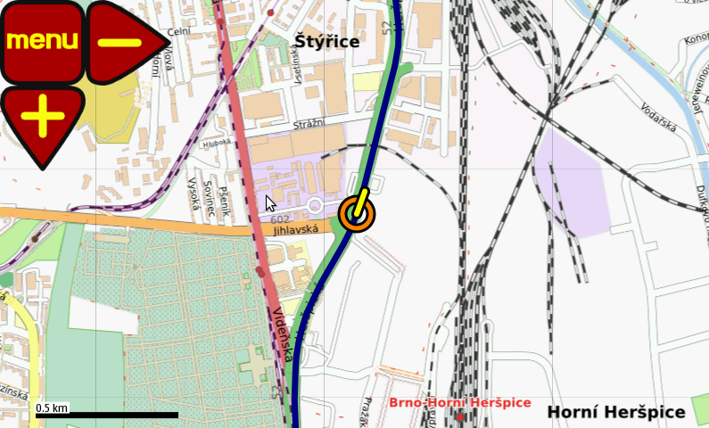
Old position indicator from Rana was replaced by a new TangoGPS inspired indicator. The immediate are of the current position is now better visible and for low speed, the direction is not show, as it is unreliable when the speed is too low.
A demonstration of the new position indicator, shown in N900 emulator
Batch tile download
ModRana supports advanced batch tile download with various download options:
- where: around the current position, around current map view or around a tracklog
- size a download are radius from 5 to 160 km
- zoom range it is possible to set the zoom level range for download (up and down)
The tiles are downloaded using threads, so it is possible to use modRana as usual while the tiles are being downloaded. It is also possible to accurately measure the size of the current download batch.
Finished batch download is indicated by a OSD message.
Notification support
ModRana has a simple OSD notification feature. This is used for example for notifying N900 users about a missing package, needed for GPS support.
Optimized tracklog drawing, tracklog manager
Tracklogs in the GPX format are supported. Drawing of tracklogs is highly optimized, so it is possible to show many tracklogs at once.
Adding of elevation data to tracklog
ModRana supports adding of elevation data from Geonames to tracklogs. The new elevation data (for all points in tracklog) is also saved to the corresponding tracklog GPX file (so it can be used by other applications). The route profile feature uses the elevation data to showing the graph.
Route profile drawing
If a tracklogs contains elevation data for its points, a route elevation profile is shown. The route profile can be also activated as an information widget.
to add elevation data top a tracklog, use the feature for adding elevation data to tracklog.
POI manager
Sorted POI are shown in a list. POI created from Google Local Search results contain all the adition information. A POI can be used as a target for routing.
Finding POI using Google Local Search
ModRana supports searching for poi around the current position, results are shown in the map. Google Local Search results often include not only name and position, but also address and phone numbers.
It is possible to search for POI from many categories, like restaurants, ATMs, hotels etc. Maximum number of results and ordering styl can be configured in options->Online services.
Online routing using Google Directions
Online routing in modRana uses Google Directions. Because of this, it wont work withou internet connectivity, but the results can be saved as tracklogs for later use. While searching for a route, the current mode is respekted. For "walking mode" walking directions would be searched, for car mode -> directions for a motor vehicle, etc. In options->Online routing toll and highway avoidance can be activated.
Start and destination can be sat as points on the map or current position can be used as the start or destination. It is also possible to set the start and destination as an address or decimal geographic coordinates.
This video shows how routing in modRana works.[youtube]
Transparent map overlay
Tuto funkci lze aktivovat pomocí options -> map -> Map as overlay. Libovolnou z podporovaných mapových vrstev lze použít buďto jako pozadí nebo jako překrývající vrstvu. Je také možné nastavit stupeň krytí v rozsahu 25-100%. 100% krytí je učeno pro průhledné vrstvy :)
OSD informační ukazatele
Ke konfiguraci informačních ukazatelů slouží uživatelský konfigurační soubor user_config.conf v kořenovém adresáři !modRany. Jsou v něm okomentované ukázky nastavení různých ukazatelů, takže by s konfigurací neměl být problém :)
Do budoucna plánuji interaktivní nastavení (pozice, velikost, velikost písma, etc.) interaktivně přímo z prostředí aplikace.
Uživatelský konfigurační soubor
Uživatelský konfigurák se jmenuje user_config.conf, je v kořenovém adresáři modRany a slouží k nastavení:
- cesty k adresáři s dílci
- cesty k adresáři s tracklogy
- nastavení pozice a velikosti ovládacích prvků, pro každý profil je možné mít nezávislou sadu ovládacích prvků
- aktivaci a nastavení parametrů pro informačních ukazatele
![(please configure the [header_logo] section in trac.ini)](/trac/chrome/site/nlp-logo.png)


